Trees In the Town

posted by kakutaharuo | 2:47 PM
|
0 comments
![]()

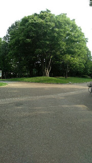
Mt. Nonodake is the main peak in the southeastern part of the hills which stretch from northwest to southeast across the Senboku Plain, and its shape is steep on the northeast side and gentle on the southwest side. For this reason, despite its 236 meters elevation, it stands out mainly from the northeast direction, in the direction of the upriver of Kitakami River. From the top, there is almost nothing to obstruct the view, offering excellent views, including not only the rice paddy fields of the Senboku Plain, but also the mountains of Iwate Prefecture, the Oshika Peninsula, and even Mt. Kinka in the distance.
What do the Oshu Three Kannon have in common? A scenic spot? A kind of. They all command fine views. Fine views of what? They all command the waterway from Taga-jo Castle to the upper reaches of the Kitakami River, where Isawa Fortress was built in 802, Shiwa Fortress was built in 803, Nakayama Fortress was built in 804, and Tokutan Fortress was built in 812. Along the waterway to the newly built fortresses, the Imperial Army advanced and carried out their logistic support. The sites of the Three Kannon looked down at their military movements. The question is who watched them. Did the northern foreigners watch to send smoke signals to the north when they detected the Imperial Army intruding? Or was it the Imperial Army that watched the northern foreigners' guerrilla fighting to interrupt the Imperial Army's advancement or logistic support?
Address: Kaguraoka-1 Nonodake, Wakuya, Toda District, Miyagi 987-0285
Phone: 0229-45-2251
Site of Tagajo Castle
Address: Ichikawa, Tagajo City, Miyagi 985-0864
Phone: 022-368-1141
Shiwa Fortress Ruins
Address: Hohatcho-47-11 Kamikazuma, Morioka, Iwate 020-0051
Phone: 019-658-1710
Shikama Fortress Ruins
Address: Soneta Ichinoseki, Shikama, Kami District, Miyagi 981-4121
Nakayama Fortress Ruins
Address: Kurakakeyama Hanaizumicho Nagai, Ichinoseki, Iwate 029-3206
Tokutan Castle
Address: Dai 6 Chiwari Nishitokuta, Yahaba, Shiwa District, Iwate 028-3603
posted by kakutaharuo | 2:47 PM
|
0 comments
![]()
Hitsujizaki Shrine was founded in 271, just a couple of decades after Cao Rui (204 or 205–239), the second emperor of the state of Cao Wei, or Cao Fang (232–274), the third emperor, recognized a Japanese queen as the ruler of Japan. It’s surprisingly old. In those days, the queen’s rule didn't reach even Ise Bay, needless to say the Tohoku Region. Then, the shrine must have been founded by those who were later called northern foreigners in the hill which commands the mouth of Kitakami River.
In legendary times, Okinagatarashi, a legendary empress, was said to have made a military expedition to Silla in the Korean Peninsula. A historical record of the Three Kingdoms of Korea (Goguryeo, Baekje, and Silla) recorded 14 organized piracies by Wa, the Japanese kingdom, by the end of the 4th century, and Okinagatarashi’s expedition to Silla might have been one of those piracies.
Some Japanese tribes supported the piracies. One of them believed in Watatsumi, a tutelary water deity in Shinto. The tribe later advanced to the mouth of the Kitakami River and enshrined their god at the northern foot of Hitsujizaki Shrine.
At the turn of the 5th century, General Taji was dispatched from Kozuke Province to Ishiminato, namely Stone Port, which was located at the mouth of Kitakami River, to suppress the northern foreigners around the port. He, however, was killed in battle.
Oshika County was organized in the first half of the 8th century. In 759, Monou Fortress was built in the north of the port and Monou Couty became independent from Oshika County. In those days, the new pirate-like settlers from the west developed Jori-system-like rice fields at the northern foot of Hitsujizaki Shrine along Mano River, a branch of Kitakami River.
In the 8th century, rice fields were rezoned by the unit of 11,881 square meters. Horizontal 6 units were called Jo, and vertical 6 units were called Ri. Accordingly, the rezoning system was called the Jori system. On March 26th, 815, 36 people who had developed the rice fields were given the surname Mano. It is unknown whether Mano River and Mano Village were named so after the Mano Families or vi-ce versa.
The settlers seemed to be getting a foothold in the east bank of the lower Kitakami River but the northern foreigners, who might have been called Magi, were not obedient or docile. In 816, the Imperial Army intruded into the Hitsujizaki Sanctuary and killed the chief's wife and, presumably, her female followers. They were afraid of her curse and enshrined Arya Avalokitesvara, who is the human-figure prototype of the other 6 metamorphoses, later. That means they did what should be cursed. What did they do? Genocide? Mass violence?
Later, Watatsumi was moved to Hitsujizaki Shrine. The shrine was first documented in 859. Its shrine temple, Magiyama-dera Temple, had been founded in 798. Magiyama-dera Temple was renamed Chozen-ji sometime between 1658 and 1660. The temple was abolished after the Meiji Restoration Government issued the Gods and Buddhas Separation Order in 1868. Its deity and its membership of the New Mutsu 33 Kannon Pilgrimage were transferred to Baikei-ji Temple.
Baikei-ji Temple originally belonged to Tiantai School, but, in 1363, priest Tenzen converted it to the Caodong Chan Sect. Tenzen worked hard to spread the sect in Mutsu Province.
The Southern and Northern Courts Period started in 1337. The Southern Court's forces were expelled from Mutsu Province in 1353. Peace at last? The reality is always ironic, and 4 guardian samurai coexisted in the province: Kira Mitsuie, Nihonmatsu Kuniakira, Ishido Yoshimoto (?-1354), and Shiba Iekane (1308-1356). They let county steward samurai to carry out maintenance of the public order and compulsory execution to win the support of local powerful samurai. They had bloody battles in short. Samurai who spent all their time in fighting loved Chan Buddhism rather than studying doctrines.
Address: Magiyama−8, Minato, Ishinomaki, Miyagi 986-0011
Phone: 0225-22-0914
Hitsujisaki Shrine
Address: Magiyama-7 Minato, Ishinomaki, Miyagi 986-0011
Phone: 0225-23-2815
posted by kakutaharuo | 2:45 PM
|
0 comments
![]()
Thousand-Armed Sahasrabhuja is said to have been enshrined on a hill which commands Matsushima Bay sometime between 806 and 810. By the time the New Mutsu 33 Kannon Pilgrimage was organized in 1123, the statue was worshiped as one the Oshu Three Avalokitesvara along with the #8 and #9 deities of the pilgrimage. Did scenic beauty religiously matter? Or was sightseeing already an important factor of the pilgrimage as early as in the 12th century?
Address: Miura−93, Tetaru, Matsushima, Miyagi District, Miyagi 981-0211
Phone: 022-354-3087
posted by kakutaharuo | 2:56 PM
|
0 comments
![]()
Sansei-do Hall is located in the precincts of Zuigan-ji Temple, whose foundation date wasn't recorded. The temple's precincts also have many caves where dead bodies could have been placed before the introduction of Buddhism. The area must have been a holy place since prehistoric days.
Although the hall was built in 1682 by Priest Tobaku, its statue of Arya Avalokitesvara, who is the human-figure prototype of the other 6 metamorphoses, should have been enshrined before the organization of the New Mutsu 33 Kannon Pilgrimage in 1123.
By the way, as Zuigan-ji Temple has many Avalokitesvara images, it is unknown why the one in Sansei-do Hall was chosen to be #6 deity of the New Mutsu 33 Kannon Pilgrimage.
Sansei literally means 3 Saints. The hall enshrines the images of Bodhidharma and Sugawara Michizane (845-903) as well as the Arya Avalokitesvara image.
Originally, the hall was built to face north-east, but Priest Jogen changed its direction to the south for the convenience of its worshippers and visitors.
Zuigan-ji Temple
Address: Chonai-91 Matsushima, Miyagi District, Miyagi 981-0213
Phone: 022-354-2023
posted by kakutaharuo | 8:25 PM
|
0 comments
![]()
Hokyo-in Temple was founded on a natural levee of Masuda River in Natori County, Mutsu Province, sometime between 794 and 864.
This is the only Avalokitesvara statue of the New Mutsu 33 Kannon Pilgrimage enshrined in a private lot.
Abe Shigeto, an uncle of Fujiwara Kiyohira (1056-1128), presented a Buddhist tanka poem to the statue:
The shining moon points to the sin
The morning haze covers it
Like Avalokitesvara in the distant past.
A Thousand-Armed Sahasrabhuja image was made of inlaid wood with a lacquer finish. It was enshrined in Kannon-do Hall. Later, Hokyo-in Temple was abolished with the hall left as the Natori Thousand-Armed Kannon Hall.
The hall used to be located in Masuda 2-chome, but was moved to its present place when the owner moved. The village name is said to have been derived from the development of new rice fields. The name was also pronounced Mashida, namely Added Rice Fields, in the old days.
The sons of Fujiwara Kinmitsu (?-1057) started calling their families Sato. Kinmitsu fought for Minamoto Yoriyoshi (988-1075) against Abe Yoritoki (?-1057) and was killed in battle. Some of his offspring lived in Mutsu Province. It is unknown why one of the Sato Families came to take care of the Sahasrabhuja image to which Abe Shigeto, Yoritoki's 6th son, presented a Buddhist tanka poem. Anyway, it is their offspring that take care of the image today.
Address: Yanagida-385-4 Masuda, Natori, Miyagi 981-1224
Phone: 022-382-3674
posted by kakutaharuo | 2:04 PM
|
0 comments
![]()
Both Tokura-ji Temple and Tokurasan Shrine were founded in 807 in Igu County, Mutsu Province. It is unknown whether Tokura-ji Temple was the shrine temple of Tokurasan Shrine or Tokurasan Shrine was Tokura-ji Temple's tutelatry shrine. The temple enshrined Thousand-Armed Sahasrabhuja and the shrine enshrined Goddess Ukemochi.
Before the organization of Igu County, Iku Kuninomiyatsuko ruled Iku Country. They built not only circle or square burial mounds but also keyhole-shaped burial mounds. They were the northernmost Kuninomiyatsuko on the Pacific coast that is confirmed. Omoshi or Shida Kuninomiyatsuko was documented but their whereabouts are unknown. Some say they were located in the south of Natori County and others say in the north. Natori Kuninomiyatsuko, however, declined quite early and left no signs in the Medieval samurai's days. Their shrine, Sakura Shrine, was taken over by Suwa Shrine. Kakuda Fortress was built in the county by Date Munemitsu sometime between 1558 and 1570.
Sendai Kuji Hongi, a historical Japanese text, contains 10 volumes. Its 10th volume is called Kokuzo Hongi, the Record of Local Chiefs, and lists 135 Kuninomiyatsuko. Iku Kuninomiyatsuko was one of the 135. Some territories later became provinces and others became counties. No Kuninomiyatsuko was appointed to any part of Ideha Province. The northernmost Kuninomiyatsuko along the coast of the Sea of Japan was Sado.
Address: Tokura-95 Oda, Kakuda, Miyagi 981-1514
Phone: 0224-62-5341
Tokurasan Shrine
Address: Tokura-96 Oda, Kakuda, Miyagi 981-1514
Phone: 0224-62-3359
Suwa Shrine
Address: Suwawakiminami−4, Sakura, Kakuda, Miyagi 981-1522
Phone: 0224-62-4771
Kakuda Fortress Site
Address: Gyukan-1 Kakuda, Miyagi 981-1505
Phone: 0224-63-2221
posted by kakutaharuo | 2:33 PM
|
0 comments
![]()
Kumano-Hongu-sha Shrine was invited from Kumano, Ki Province, to Natori County, Mutsu Province, in 1120. Kongo-ji Temple was founded as Kumano-Hongu-sha Shrine's shrine temple. The temple was abolished presumably after the Meiji Restoration with its Kannon-do Hall left. The hall is taken care of by Shingu-ji Temple.
Kumano-Hongu-sha Shrine
Address: Gotanda−34, Takadatekumanodo, Natori, Miyagi 981-1241
Phone: 022-386-2353
Shingu-ji Temple
Address: Iwakuchinaka-35 Takadatekumanodo, Natori, Miyagi 981-1241
Phone: 022-386-2356
posted by kakutaharuo | 2:10 PM
|
0 comments
![]()
Shuroku-ji Temple was founded in Natori County, Mutsu Province, in 798. The county is supposed to have been organized in the 7th century. The county was first documented on November 15th, 729, in a thin wooden strip used to write on. The temple came to belong to the Tiantai Sect in 807.
Between Yuriage Beach and the mountains, there is a cluster of ancient burial mounds, Iinozaka Kofun Cluster. The cluster consists of 2 square-style burial mounds and 5 larger two-conjoined-rectangle-type burial mounds, which are supposed to have been constructed from the end of the 4th century to the 5th century. The presence of so many two-conjoined-rectangle-type burial mounds in one location is unique. That is, the prehistoric rulers in the area had somewhat different culture from the Royal Family and their allies.
In the 5th century, there appeared 2 gigantic keyhole-shaped burial mounds; the bigger one is called Raijinyama Kofun and the other is called Tomizuka Kofun. It is unknown whether those who were buried in the keyhole-shaped burial mounds were the hereditary rulers who became more powerful and who imported the culture from the central part of Japan, or they came from the central part of Japan to conquer the area. Anyway, they weren't appointed to be Kuninomiyatsuko as a local ruler. The Kuninomiyatsuko system was established in the 5th century and lasted till the end of the 6th century, when the Kori system was introduced to replace Kuninomiyatsuko. The Kori system was soon replaced by the province-and-county system in the 7th century.
It is unknown whether the rulers in the Natori area appeared too late to be appointed to be Kuninomiyatsuko or were regarded too foreign to be domestic local rulers.
In the 16th century, the temple's name was changed from Shuroku-ji to Shuroku-sai. A few temples have -sai in their names.
Many temples in Japan have jigo (namely temple name), and the others have ingo (namely cloister name). Some of them even have sango (namely mountain name). The most complicated name of a temple consists of the three names. When a temple has 3 names, sango (mountain name) comes first, then the either ingo (cloister name) or jigo (temple name) comes second (not necessarily ingo comes second, as is sometimes suggested), and then comes the rest.
Sango comes from China. Buddhism first reached China during the Eastern Han Dynasty (25-220) as a foreign mysterious religion. It was accepted by intellectuals during the Eastern Han Dynasty, connecting Wuwei concept (literally meaning inexertion, inaction, or effortless action) in Taoism with the concept of Sunyata (translated most often as emptiness, vacuity, and sometimes voidness) in Buddhism. After the Six Dynasties (220-589), Buddhism flourished so much that they had many temples with the same name, as you may notice even in Japan today. They came to put a place name before the name of a temple. As Buddhist temples flourished, they accumulated wealth. There were about 4,600 monasteries, 40,000 hermitages, 260,500 monks and nuns. In 840’s, Emperor Wuzong (814-846) of the Tang Dynasty (618-907) initiated the Huichang Persecution of Buddhism to confiscate their properties. In 846, the Emperor Wuzong died, and the persecution was over. However, Buddhism never completely recovered except some Chan temples in mountains which stood aloof from the worldly businesses. Under the Kamakura Shogunate, Japan imported Chan Buddhism with the custom to put a place name (= a mountain name) before a temple name. The custom spread to other Buddhism sects and schools.
Ingo literally means a cloister name. The suffix “-in” was an honorific title. After Emperor Saga (786-842) abdicated in 823, he was called Saga-in with respect. That was the first example of using the suffix “-in” for a retired emperor. Those days, a retired emperor meant a cloistered emperor.
When Fujiwara Senshi (962-1002), the mother of Emperor Ichijo (980-1011), retired as an empress dowager, she was given an honorific title “-in” for the first time as a woman. And then some royal family members were given the honorific title “-in”. And then the temples where those with “-in” titles as the head priests came to be also called with the suffix “-in”. That was the start of ingo (cloister names) for temples.
As the ancient aristocracy collapsed, the naming custom spread to other ruling classes, such as samurais, and so did ingo for temples. Many temples with ingo in the middle of the three, use it to show the high status of them.
Meanwhile, the suffix “-in” also meant retirement, sub-temples for retired priests in the precincts of large temples came to be named with it. And then the naming custom spread to other sub-temples and even branch temples. Those temples put their ingo usually at the tail of the three.
At first, Japan had only 46 temples. In the Kamakura Period, there were over 13,000 temples. In the Edo Period, the number exceeded 0.4 million. In those days, -an, -sai, and -bo were also used as jigo. An means a thatched-roofed hut. Sai means a study. Bo means a house for a monk. After the Meiji Restoration, the number of temples decreased to about 70 thousand.
Address: Kamikanohigashi-88 Takadateyoshida, Natori, Miyagi 981-1242
Phone: 022-384-7270
Kasui-sai Temple
Address: 2915-1 Kuno, Fukuroi, Shizuoka 437-0061
Phone: 0538-42-2121
Raijinyama Kofun
Address: Yama−1, Umematsu, Natori, Miyagi 981-1226
Phone: 022-384-2111
Tomizuka Kofun
Address: 23, Wakabayashi Ward, Sendai, Miyagi 984-0823
posted by kakutaharuo | 2:04 PM
|
0 comments
![]()
Legend has it that an Eleven-Faced Ekadasamukha image was washed up on Yuriage Beach in the 7th century. Jogaku-ji Temple was founded at the foot of a nearby hill to enshrine the image.
As the beach is on the sea route between Kashima Jingu Shrine and Tagajo Castle, it is highly probable that a ship on its way to the castle was wrecked off the beach and the image it was carrying was washed ashore.
Kashima Shrine was officially considered and actually worked as the gateway to invade the Tohoku Region, the northeastern part of Honshu, which was later called Mutsu Province, or to subdue and rule northern foreigners who were not subject to the Imperial Court. As Tagajo Castle was built in 724, it was still under construction when the image was washed ashore.
The Imperial Court and its predecessor, the Royal Family, basically invaded the Japanese Archipelago by sea.
Ugaya, whose ancestors had come from somewhere else which got called Takamagahara later, was ruling Hyuga Province in the eastern coast of Kyushu Island. He had been abandoned by his mother in his infancy, and raised by his aunt, his mother’s younger sister. When he came of age, he married the aunt, and had 4 sons, Itsue, Inahi, Mikenu, and Sano.
Inahi drowned himself in the sea to see his mother. Mikenu left eastward, that is, to the sea, for the land of the dead. Itsuse left northward with his youngest brother, Sano. The reason for the family breakdown is unknown and unknowable now.
Itsuse first arrived at Usa in Buzen Province, and stayed at another place in the province for a year. He moved on eastward along the Seto Inland sea to Aki Province, and stayed there for 7 years. And then to Kibi Province, and stayed there for 3 to 8 years. He finally reached the eastern end of the Seto Inland sea only to be faced by Nagasune, who was hostile against him. Itsuse was shot, flew, got to O Port in Ki Province, and died there. He was buried in Mt. Kama near the port.
Itsuse’s younger brother, Sano, continued their eastward quest, and arrived at Kumano in the province. Tempted by a local tribe, who had the token of a crow with 3 legs, he went upstream along Totsu river, crossed Yoshino River, beat his way through the bush, and reached Uda in Yamato Province.
The 3-legged-crow tribe helped Sano rival other local tribes there, and successfully split one tribe. Sano’s men committed an underhanded murder of another local tribe. Sano also maneuvered pork-barrel politics against other tribes, and established his ruling in Iware. He was later called Iware, related to his domain name. Until the end of World War II, the series of events was widely believed in Japan to have taken place more than 2 millennia before.
Sano’s offspring eventually unified Yamato Province, and formed the Royal Family. They even further continued the brothers’ eastward quest. After Kumano, they reached Ise. They built their advanced base at the southern end of the Ise Plains, Ise Shrine. Next, they invaded Nobi Plains, and built another advanced base at the mouth of a river in Owari Prefecture, Atsuta Shrine. They moved further east, got to an inland sea at the eastern end of the Kanto Plains, and built another advanced base at the southern shore of the sea, Katori Shrine. Across the inland sea, at the northern shore, they also prepared another advanced logistics base, Kashima Shrine, to invade Northern Japan.
Address: Nishimasaka-17 Takadateyoshida, Natori, Miyagi 981-1242
Phone: 022-382-3872
Yuriage Beach
Address: Higashisuka Yuriage, Natori, Miyagi 981-1213
Kashima Jingu Shrine
Address: 2306-1 Kyuchu, Kashima, Ibaraki 314-0031
Phone: 0299-82-1209
Katori Jingu Shrine
Address: 1697 Katori, Chiba 287-0017
Phone: 0478-57-3211
Site of Tagajo Castle
Address: Ichikawa, Tagajo City, Miyagi 985-0864
Phone: 022-368-1141
posted by kakutaharuo | 3:13 PM
|
0 comments
![]()
Asahi, a maiden in the service Shinto in Shiga Village, Natori County, Mutsu Province, organized the New Mutsu 33 Kannon Pilgrimage in 1123.
When the Old Mutsu 33 Kannon Pilgrimage was organized in 811, people living in the area composed of soldiers and farmer-soldiers of the Imperial Army, who belonged to the Yayoi Culture, those who belonged to the Jomon Culture, and those who belonged to the Satsumon Culture. Whether they shared the same ethnicity or not is still controversial.
In the 11th century, there were powerful ruling families in the Tohoku Region, the Abe Family in Mutsu Province and the Kiyohara Family in Dewa Province. From 1051, the region was in a period of war. After the wars, the Northern Fujiwara Clan became the hegemon, spreading their power over the present-day Tohoku region. Based in Hiraizumi, they prospered from 1087 to 1189.
In 1117, they revived Motsu-ji Temple in Hiraizumi, Iwai County, Mutsu Province. In 1124, they built Konjiki-do Hall in the precincts of Chusonji Temple. The New Mutsu 33 Kannon Pilgrimage was organized when the Northern Fujiwara Clan tried to reproduce the Pure Land of Perfect Bliss to justify their rule. It was in those days that the New Mutsu 33 Kannon Pilgrimage was organized within the sphere of their influence.
After the Southern and Northern Courts Period (1336-1392), samurai in the Tohoku Region rivaled one another, it became difficult to visit the pilgrimage through hostile territories. In 1761, the pilgrimage was revived under the Pax Tokugawana. It is unknown whether or not some of its member temples were changed when the pilgrimage was revived.
Motsu-ji Temple
Address: Osawa-58 Hiraizumi, Nishiiwai District, Iwate 029-4102
Phone: 0191-46-2331
Konjiki-do Hall of Chusonji Temple
Address: Koromonoseki-202 Hiraizumi, Nishiiwai District, Iwate 029-4102
Phone: 0191-46-2211
posted by kakutaharuo | 2:14 PM
|
0 comments
![]()
I have virtually walked up the Old Mutsu 33 Kannon Pilgrimage. It's surprising that some member temples were located in the territories of the Imperial Army, some others were founded in the territories of northern foreigners, who belonged to the Jomon Culture, and the others were founded in the land of the Satsumon Culture. In today's sense, the pilgrimage's organizers had a very international perspective. It is also interesting that Ideha Province’s emerging rulers seem to have tried to amalgamate and syncretize northern-foreigner local faith with Shinto and Buddhism, but that those of Mutsu Province were interested in introducing Buddhism directly.
posted by kakutaharuo | 2:38 PM
|
0 comments
![]()
An Avalokitesvara image was enshrined in a hill along Appi River. The river's valley has been an important point of transportation between the Kitakami River Basin in the south and the Pacific in the north. Even today, the Hachinohe Expressway runs through the valley.
It is unknown where its original statue has gone. In the 11th century, a new image was made and Tendai-ji Temple was founded to take care of it.
In 811, when the Old Mutsu 33 Kannon Pilgrimage was organized, Shiwa County was organized as the northernmost territory of the Imperial Court in Mutsu Province. The county expanded northward gradually, and, in the 10th century, its northern half became an independent county, Iwate County.
In 811, accordingly, the Appi River Basin was still the territory of northern foreigners who belonged to the Jomon Culture.
Address: Oyamakubo-33 Joboji, Ninohe, Iwate 028-6942
Phone: 0195-38-2500
posted by kakutaharuo | 2:10 PM
|
0 comments
![]()
Mido is an honorific of a hall. When the Old Mutsu 33 Kannon Pilgrimage was organized in 811, there should have been a hall which enshrined an Avalokitesvara image in a territory which was later called Nukanobu County. In those days, the area was inhabited by northern foreigners who belonged to the Jomon Culture.
In 1070, Minamoto Yoritoshi, the Governor of Mutsu Province, and Kiyohara Sadahira advanced north and reached Ezowake-shima Island, whose whereabouts are still controversial. Some argue the island was Hokkaido, while others say it was a part of the Tohoku Region. Anyway, the main strength of the expedition force was the Kiyohara Clan.
While Yoritoshi was in the battle front, Fujiwara Motomichi, a local official of Mutsu Provincial Government, stole the Governor's seal and the key of provincial warehouses. Yoritoshi was dismissed, and Sadahira had the achievement of the war all to himself. In addition, Sadahira gained supremacy in the sea route along the Pacific Ocean.
It was after the expedition that Nukanobu County was organized. That is, the area became under the control of the Imperial Court nominally. In reality? Emerging samurai class advanced to the area which the Imperial Court hadn't been able to conquer.
It means those who supported the hall maintained their independence for 2 and a half centuries. It is unknown how long the hall lasted.
Address: Mido Tsunogaraori, Hashikami, Sannohe District, Aomori 039-1208
posted by kakutaharuo | 3:21 PM
|
0 comments
![]()
It is unknown when Kyodo-ji Temple was founded in today's Matsumae District, Hokkaido. It was changed to Obaku Chan School in 1704 by Priest Hakuan. It is even unknown whether its original name was Kyodo-ji or not. It is not surprising that the northern end of Honshu and the southern end of Hokkaido shared the same culture to organize one pilgrimage together. Archaeologically speaking, the Satsumon Culture spread in the northern part of Honshu, the southern part of Hokkaido, and Sakhalin, and lasted from the 7th century to the 13th century. If the Satsumon culture people were involved in organizing the Old Mutsu 33 Kannon Pilgrimage, it was probable that they included a temple across the Tsugaru Strait.
In 1911, Kyodo-ji Temple was merged to Hogen-ji Temple, which also belongs to Obaku Chan School.
Obaku Chan School is one of 3 main schools of Japanese Chan Buddhism, in addition to the Linji School, which was imported in the 12th century, and Caodong School, which was imported in the 13th century. The Obaku School was founded in Japan by the Chinese priest Yinyuan (1592–1673), who immigrated to Japan during the Manchu conquest of China in the 17th century. Relatively a newcomer, the school might have tried to extend their frontier, making use of local ancient worship.
Address: 82 Yamagatamachi, Kuroishi, Aomori 036-0364
Phone: 0172-52-3644
posted by kakutaharuo | 2:16 PM
|
0 comments
![]()